Garmin inReach Mini 2: Why This 3.5 oz Lifesaver Belongs in Your Pack
Whether you’re trekking through alpine trails, kayaking remote coastlines, or navigating the desert solo, one truth remains: when you’re off the grid, communication can mean survival. The Garmin inReach Mini 2, a palm-sized satellite communicator weighing just 3.5 ounces, redefines what it means to stay connected in the wild. With global Iridium network coverage, reliable SOS features, and field-tested navigation tools, this device is more than a luxury—it’s a non-negotiable safety net for adventurers in 2025. Here’s why it deserves a permanent place in your gear setup.
Compact Yet Powerful: Design & Durability Features
The inReach Mini 2’s physical specifications immediately set it apart in the crowded field of outdoor technology. Measuring just 4″ x 2″ and weighing a mere 3.5 ounces (99g), it’s approximately 30% smaller than comparable satellite communicators from competitors. For context, the device weighs less than a standard energy bar, making it practically unnoticeable when packed.
This miniaturization comes without compromising durability. The device meets MIL-STD-810 standards—a set of rigorous military specifications for equipment reliability under extreme environmental conditions. These standards involve testing for resistance to drops, shocks, vibration, extreme temperatures, and altitude changes. For outdoor enthusiasts, this translates to a device that can withstand falls onto rocky terrain, exposure to freezing temperatures, and the general abuse of backcountry travel.
Weather Resistance That Matters
The IPX7 water resistance rating ensures functionality even after immersion in one meter of water for up to 30 minutes. This protection extends beyond simple rain exposure to cover scenarios like accidental submersion during river crossings or recovery after dropping the device in snow. The practical implication: you won’t need to worry about protecting the Mini 2 during unexpected weather events or water encounters.
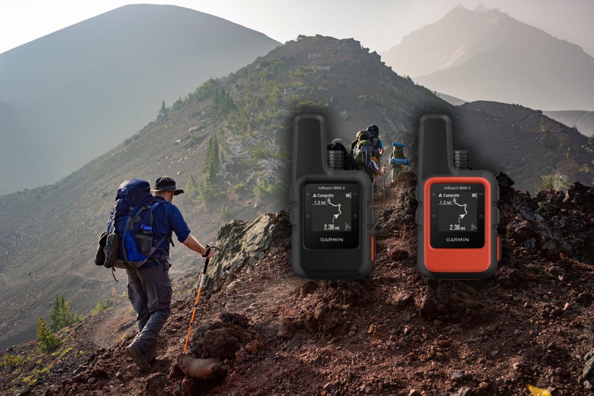
The Flame Red color option offers practical advantages beyond aesthetics. High visibility in outdoor environments reduces the chance of misplacing the device at camp or during breaks, while also making it easier to locate quickly in an emergency situation when seconds count.
Button placement and screen design reflect thoughtful engineering for field use. The interface remains navigable with gloves on, and the monochrome display offers excellent visibility across lighting conditions from direct sunlight to pre-dawn darkness.
Global Connectivity: The Iridium Network Advantage
The backbone of the inReach Mini 2’s communication capabilities is the Iridium satellite network—currently the only commercial satellite system providing 100% global coverage, including polar regions. This network consists of 66 active satellites in low Earth orbit, ensuring that users maintain connectivity regardless of their location, from Himalayan peaks to Antarctic expeditions.
Two-way messaging constitutes the primary communication method, allowing users to send and receive 160-character text messages to any cell phone number or email address. Message transmission typically takes 20-60 seconds, depending on satellite positioning and environmental factors. While not instantaneous like cellular communication, this speed proves more than adequate for coordinating logistics or providing updates to concerned family members.
Emergency Response When It Matters Most
The interactive SOS functionality connects users directly to the GEOS International Emergency Response Coordination Center, a 24/7 monitoring service that coordinates with local search and rescue agencies worldwide. Unlike one-way emergency beacons, the two-way capability allows users to describe their emergency, receive confirmation that help is coming, and get estimated arrival times—critical information during high-stress situations.
Weather forecast access provides vital data for trip planning and risk assessment. Users can request detailed forecasts for their current location or any waypoints on their route, receiving information on temperature, precipitation, wind speed, and barometric pressure—potentially life-saving data when conditions deteriorate unexpectedly.
Location sharing capabilities allow automated tracking at predetermined intervals, creating a digital breadcrumb trail that friends and family can monitor through the Garmin Explore website. Preset messages streamline routine check-ins, allowing users to send pre-written updates with their location data attached at the push of a button.
Battery Performance That Goes the Distance
Long expeditions demand reliable power sources, and the inReach Mini 2 delivers impressive endurance. At standard 10-minute tracking intervals, users can expect approximately 14 days of continuous operation—sufficient for most backpacking trips and shorter expeditions. Extended journeys benefit from the adjustable tracking settings, with 30-minute intervals stretching battery life to approximately 30 days.
Strategic power management further extends usability in the field. Toggling off unnecessary features like Bluetooth connectivity when not actively paired with a phone conserves significant power. Similarly, reducing screen brightness and minimizing manual GPS checks preserves battery for essential functions.
Power Options Beyond the Built-In Battery
The included accessories enhance charging flexibility. The 10ft USB Type-C cable provides sufficient length for connecting to power sources in various camp setups, while the included USB charging adapters and car adapter ensure compatibility across power sources from wall outlets to vehicle ports. The bundled P-Bank Portable Battery Charger serves as a secondary power source for extending operations beyond the device’s internal battery capacity.
Cold weather notably impacts lithium-ion battery performance, with efficiency decreasing as temperatures drop below freezing. For winter expeditions, storing the device close to body heat when not in use and keeping the portable battery charger in an insulated location maintains optimal power availability when needed most.
Navigation Tools for the Directionally Challenged
The TracBack routing functionality transforms the return journey by automatically creating a navigable route back to your starting point. This feature records your path during the outbound journey, then provides turn-by-turn guidance for retracing your steps—invaluable when fatigue sets in or visibility becomes compromised during the return trip.
Traditional GPS units struggle to provide directional information when stationary, typically requiring movement to calculate heading. The Mini 2’s digital compass overcomes this limitation by delivering accurate bearing information even when standing still, allowing users to confirm their intended direction before moving. This capability proves particularly valuable when navigating in dense forest or fog where landmarks may be obscured.
Mapping and Route Planning
Waypoint marking enables users to flag important locations—campsites, water sources, trail junctions, or hazards—for future reference. The system stores up to 500 waypoints, more than sufficient for extended journeys, and allows custom naming and categorization for efficient organization.
The device interfaces with detailed topographic maps through the companion Garmin Explore app, displaying current position within the broader geographical context. While the Mini 2’s small screen limits detailed map viewing on the device itself, the integration with smartphone apps creates a powerful navigation system combining the reliability of satellite connectivity with the visual clarity of a larger screen.
Field testing confirms GPS accuracy within 5-10 meters under typical conditions, sufficient precision for wilderness navigation. Signal acquisition typically occurs within 60 seconds of powering on, even under moderate tree cover or in narrow canyons where satellite visibility might be partially obstructed.
Seamless Ecosystem Integration
The Garmin Explore app extends the Mini 2’s functionality through intuitive trip planning features and comprehensive data management. Users can create routes on topographic maps, organize waypoints, and plan expeditions from the comfort of home before syncing this information to their device. The interface balances detailed information with accessibility, requiring minimal technical expertise to operate effectively.
Cloud storage automatically backs up all routes, waypoints, and tracking data, creating both a safety record and a catalog of past adventures. This feature ensures that even if the physical device is lost or damaged, the critical navigation information remains accessible through any internet-connected device.
Cross-Device Compatibility
The inReach Mini 2 communicates seamlessly with other Garmin products, particularly their outdoor-focused GPS watches like the Fenix and Instinct series. This integration allows control of messaging and tracking functions directly from the wrist—convenient when the Mini 2 is stored in a pack during active movement.
Additional app compatibility extends functionality into specialized activities. Garmin Messenger enhances communication capabilities with group messaging features, while Garmin Pilot provides aviation-specific weather reports and flight plan submission tools for backcountry pilots and air sports enthusiasts.
Mobile device pairing occurs via Bluetooth, with connection typically established within 30 seconds. The primary limitation involves battery drain on both devices when actively paired, necessitating strategic connection management during extended trips. Compatibility extends across current iOS and Android platforms, though some advanced features may require recent operating system versions.
Subscription Plans: Understanding Your Options
Activating the inReach Mini 2 requires selecting from several subscription tiers, each balancing cost against feature availability. The Safety plan provides basic emergency functionality at the lowest price point, while Freedom plans offer month-to-month flexibility for seasonal users. Expedition plans deliver unlimited messaging and higher tracking frequency for professional guides and serious adventurers.
Annual contracts provide approximately 30% cost savings compared to month-to-month Freedom plans, making them economical for regular users. However, the Freedom plans’ ability to activate and deactivate service monthly without penalties offers significant advantages for seasonal adventurers who might use the device intensively during summer and winter expeditions while requiring minimal functionality during shoulder seasons.
Subscription Features and Management
Each subscription tier includes different messaging allowances, tracking intervals, and weather forecast access. The Recreation plan represents the most popular option, balancing 40 messages per month with 10-minute tracking intervals—sufficient for most recreational users’ needs while maintaining reasonable costs.
Activation occurs through Garmin’s online portal, typically completing within 20 minutes of registration. Plan management, including upgrades, downgrades, or seasonal suspension, can be handled through the same interface with changes taking effect at the next billing cycle.
Strategic seasonal users often activate comprehensive plans during primary adventure months, downgrade to basic safety coverage during shoulder seasons, and suspend service entirely during known periods of inactivity—optimizing the balance between coverage and cost.
Real-World Applications & User Experiences
Hikers and backpackers represent the largest user demographic, with the device’s lightweight profile and extended battery life aligning perfectly with multi-day trail requirements. Long-distance thru-hikers on routes like the Pacific Crest Trail and Appalachian Trail particularly value the ability to coordinate resupply logistics and communicate changes in itinerary while maintaining minimal pack weight.
Marine applications extend from kayakers exploring coastal waters to bluewater sailors crossing oceans. The global coverage eliminates the connectivity gaps experienced with marine VHF radio and cellular systems, while the weather forecasting functions provide critical decision-making data when storm fronts approach.
Critical Emergency Applications
Search and rescue professionals report significant improvements in response efficiency when subjects carry satellite communicators. The precise GPS coordinates eliminate the time-consuming search phase of rescue operations, while two-way messaging capability allows responders to gather vital information about injuries and conditions before arriving on scene.
International travelers face unique communication challenges when venturing beyond tourist infrastructure. The inReach Mini 2 provides consistent connectivity regardless of local telecommunications development, functioning equally well in remote Mongolian steppes or Patagonian mountains without requiring different equipment or service plans for different regions.
Hunters and anglers who pursue their activities in remote backcountry settings benefit from both safety features and specialized applications. The ability to mark productive fishing spots or game sightings creates a valuable record for future trips, while location sharing allows hunting partners to coordinate movements across terrain without requiring visual contact.
What’s in the Box: Complete Package Analysis
The bundled accessories enhance the Mini 2’s utility straight from unboxing. The 10ft USB Type-C cable exceeds standard cable lengths, providing practical flexibility when charging from vehicle power sources or awkwardly positioned outlets in backcountry lodges and hostels. The cable’s reinforced connection points demonstrate thoughtful design for field use where equipment regularly faces stress.
USB charging adapters for standard wall outlets and vehicle power ports ensure compatibility across common power sources. The adaptability proves particularly valuable during international travel where access to specific outlet types may be unpredictable.
Power Extension and Maintenance
The included P-Bank Portable Battery Charger functions as a power extension system, storing approximately 3-4 complete recharges for the Mini 2. At 5000mAh capacity with dual USB outputs, this accessory supports charging multiple devices simultaneously—a noteworthy advantage when managing both the inReach and a smartphone during extended backcountry stays.
The 6Ave Microfiber Cleaning Cloth provides appropriate maintenance for the device’s screen and housing. Regular cleaning prevents mineral buildup around buttons and ports that could potentially compromise water resistance or button functionality over time.
The package lacks a dedicated carrying case or belt clip, though these accessories can be purchased separately. First-time users might consider adding a silicone protective cover for additional impact protection and improved grip when operating with cold or wet hands. Similarly, a carabiner attachment point or lanyard would enhance accessibility when the device needs to remain readily available.
Protection Plan Options: Safeguarding Your Investment
The available protection plans address the realities of outdoor equipment use where damage often results from specific incidents rather than general wear. The 2-year Portable Electronic Accident Protection Plan covers accidental damage including impacts, liquid exposure, and component failure, with 24/7 support and streamlined claims processing designed to minimize equipment downtime.
For those planning extended ownership, the 3-year plan extends identical coverage for an additional 12 months at a marginally higher price point, offering better long-term value for dedicated outdoor enthusiasts who anticipate using the device regularly across multiple seasons and environments.
Comprehensive Coverage Considerations
The Complete Protect Plan operates differently, functioning as a monthly subscription covering multiple Amazon purchases rather than being device-specific. This option provides particular value for households with numerous electronic devices, effectively creating an umbrella policy that simplifies coverage management across gear collections.
The claims process follows standardized procedures requiring documentation of the damage or malfunction, typically through photographs and written descriptions. Resolution generally occurs within 3-5 business days for standard claims, with expedited processing available for emergency situations where equipment replacement directly impacts scheduled expeditions.
Coverage limitations primarily involve intentional damage, cosmetic issues that don’t affect functionality, and loss or theft—situations better addressed through homeowner’s or renter’s insurance policies. For wilderness users, the most relevant coverage involves water damage beyond the device’s IPX7 rating and impact damage from falls exceeding the MIL-STD-810 specifications.
Analyzing cost-benefit ratios, protection plans typically justify their expense for users who regularly expose equipment to challenging conditions. Weekend hikers on established trails might find less value in additional coverage, while backcountry guides, expedition leaders, and adventure travelers—whose income or safety directly depends on equipment reliability—often consider protection plans essential insurance against costly equipment failure in remote locations.
The Verdict: Is the inReach Mini 2 Worth It?
The Garmin inReach Mini 2 isn’t just another piece of outdoor tech—it’s peace of mind in your pocket. Lightweight yet powerful, it bridges the gap between exploration and safety, letting you venture farther without sacrificing connection. With robust battery life, real-time two-way messaging, and a proven emergency response system, it’s the kind of investment that pays for itself the moment things don’t go as planned. For anyone pushing beyond the bounds of cell service, the Mini 2 isn’t optional—it’s essential.